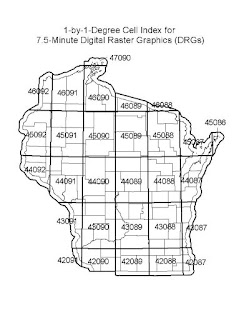
http://dnr.wi.gov/maps/gis/datadrg.html
This is a cadastral map which shows a reference for other raster maps. Since the raster files are so large, most providers limit the scope of area which the map covers. A reference map, like this, helps guide a user to the location of interest.

No comments:
Post a Comment