Tuesday, November 22, 2011

Pie chart

http://www.avert.org/usa-statistics.htm
This is a pie chart to represent the proportion of the male and female populations and how they contracted HIV.

Population profile

http://pewhispanic.org/

This map profiles different segments of the population living in poverty.

Highway map of US

http://www.onlineatlas.us/interstate-highways.htm
This is a planimetric map of the United States, with the different states identified by different colors.  The interstate highways are featured on this map.

Frequency distribution

http://www.psychstat.missouristate.edu/introbook/sbk07.htm
This is a frequency distribution plot.  This shows the count for different events that happened.  In this plot the categories are nominal and show the amount of times an event occurred.  If you were to add the total number of events and divide each category by the amount of times it occurred in that category, you would have the relative frequency for each category.

Parallel Coordinates

http://www.juiceanalytics.com/writing/parallel-coordinates/

This is a map of parallel coordinates.  This is an example of automobiles, where there are many variables to determine the performance of a car.  Each of the vertical axis represents the range of values for a parameter.  These include number of cylinders, displacement, weight, horsepower, acceleration, mpg, year and origin.  It would be ideal to have a car which performs great in each category, but there are always compromises, cut the performance in one aspect to boost the performance in another.  This chart helps illustrate the differences.

Correlation matrix

http://www.inductive.com/help-doc-correl.htm
This is a correlation matrix.  All of the variables are listed on both the x and the y axis.  This provides a way to show a combination of each of the variables and list their independent correlation.  Each variable is perfectly correlated with itself because they have the same variation.  The other correlations are less than 1 or greater than -1 because that is the scale of a correlation.

Starplot for car analysis

http://itl.nist.gov/div898/handbook/eda/section3/starplot.htm
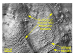
This is a starplot.  Each of the axis represents a something to measure about the subject.  In this car example, the axis represent price, mpg rating, repair rates, headroom, rear seat room, trunk space, weight, and length.  By having multiple axis, the plot is able to communicate a lot of information about the car, and the user is able to compare a lot of features among many cars easily.  For example, it seems that many of the cars sacrifice great mileage to have other features like headroom, rear seat room, trunk space, weight and length.

Isoline map for pipe design

http://www.engineeringtoolbox.com/moody-diagram-d_618.html

This is an isoline map which relates various engineering parameters to estimate energy loss in a pipe.  Each line represents a possible condition which could be met by the parameters.

Isoline map for rainfall depth

http://www.ems-i.com/wmshelp/Hydrologic_Models/Models/Rational/Editing_Rational_Method_Parameters/Rainfall_Intensity.htm

The Intensity-Duration-Frequency (IDF) curve is a way to represent three dimensions in a two-dimensional space.  This is an isoline map because each line represents the combination of rainfall intensity and duration that would produce the same amount of volume of rain.  There are a series of these maps that are produced for different frequency periods.  For example, a 2-year storm produces a different depth than a 50-year storm, and each will have an IDF curve.

Triangular Plot

http://rpitt.eng.ua.edu/Class/Erosioncontrol/Module3/Module3.htm
This is a triangular plot to describe soil texture.  There are three variables to classify soil: percent clay, percent silt, and percent sand.  These three variables have different physical and chemical characteristics and the combinations provide soils that behave differently: silt loam, sandy loam, and clay.

Stem and Leaf plots

http://www.purplemath.com/modules/stemleaf.htm
A stem and leaf plot is a way to illustrate the distribution of values.  It is a clever way to organize the data because it makes it easy to recognize the minimum, maximum, median and range.

Histogram for photographers

http://www.luminous-landscape.com/tutorials/understanding-series/understanding-histograms.shtml

A histogram is a way of showing a distribution.  In this example, the histogram is showing the distribution of tone across a spatial digital image.  The higher the value represents a darker tone, which indicates that the image is underdeveloped.  The lower value represents a lighter tone, which indicates that the image is overdeveloped.  A photographer has tools to control the amount of light entering the lens, so the histogram gives important information about the potential for a well balanced photo.

Wind rose map

http://www.bom.gov.au/climate/averages/wind/wind_rose.shtml

This is a wind rose map.  This type of map is used to communicate the direction and speed of the wind.  There are 8 possible directions that a branch could point.  If a branch is pointed N, NE, E, SE, S, SW, W, or NW, this means that wind is detected in that direction.  The thickness and the length of the branch are also important symbols.  The thickness represents the wind speed ranges and the length is proportional to the frequency of the winds.

Economic index plot

http://www.themacrotrader.com/category/asset-allocation/
This is an index value plot.  The dark blue line is the Global Macro Index and the purple line is the SP500.  Both variables show their performance in time if you had an initial investment of $1000 in each starting in October 2007, which is the beginning of the economic recession.  This is an index because it starts at an arbitrary benchmark and the information that it is telling you is the relation to that benchmark through time.  The Global Macro Index never goes below the starting value, while the SP500 has always stayed below the starting value.

Scatterplot

http://www.stat.yale.edu/Courses/1997-98/101/scatter.htm
A scatter plot is a tool to show correlation.  A set of data is plotted on the x-axis and another set of data is plotted on the y-axis.  The data may be independent or dependent, depending on the information that you are trying to communicate.  This plot shows a loose negative correlation; as X increases, Y decreases.

Correlations in data

http://www.mathsisfun.com/data/correlation.html
These plots illustrate the levels of correlation between two sets of data.  The first plot is a perfect correlation, which means that the data vary at the same rate over the same parameter.  When data are more loosely correlated, it means that they respond differently to the same input.  So this assumes that each of the data are dependent on a third parameter, like time or space for example.

Cumulative line graph

http://www.mathsisfun.com/data/cumulative-tables-graphs.html
This is a cumulative line graph.  It shows the absolute value in savings over time.  The slope of the line tells us the rate of accumulation at a single point in time. 

Bivariate choropleth map

http://proceedings.esri.com/library/userconf/proc99/proceed/papers/pap171/p171.htm
This is a bivariate choropleth map.  The dot patterns represent median house value, while the shades of purple represent the population of the area.  By having two sets of classified symbols in a map it is possible for the reader to recognize patterns and correlations between the two data sets.
http://improving-visualisation.org/vis/id=3

This is a funnel plot and a map.  On the left hand side, there is a univariate choropleth map showing the proportion of the population which are in criminal institutions.  The classifications are divided by quantiles.  Each of the regions is a data point in the funnel plot.  The Number of People Institutionalized is on the x-axis, and the Percent of the Population Institutionalized is on the y-axis.  The Iberville Parish is highlighted by the yellow lines.  It has roughly 3,000 people in prison, which is 93% of the population.  The funnel plot is a tool to give more information to a choropleth map.

Choropleth map with proportional symbols

http://geographyfieldwork.com/DataPresentationMappingTechniques.htm
This is a choropleth map with proportional symbols.  The shades of purple represent classifications of population density.  In this example the classes are divided by set intervals (not natural breaks or by standard deviation).  The pie charts represent the differences in land use within the region.  By having two sets of symbols on the map, it is able to communicate more information about the area.

Interactive dot density map

http://www.city-data.com/city/Florida.html

This is an interactive dot density map on a planimetric map.  The dots represent major cities in Florida, but the website has many features that you can plot over the state of Florida.

DOQQ maps

http://www.geology.enr.state.nc.us/doqq.html
A Digital Orthophoto Quarter-Quadrangle (DOQQ) map is an aerial image that has been rectified.  The rectification process removes any angle or distortion in scale.  In geometry, "ortho" means perpendicular, so an orthophoto is one that is perpendicular to the image.

Land survey


 This is a land survey map.  The data are collected manually by a surveyor with a laser and a mirror.  The laser measures distance and angle with great precision.  The data is then tied into the state plane coordinate system to create plats. 

Soviet propoganda map

http://flowingdata.com/2010/07/15/maps-that-changed-the-world/

This is a propoganda map because it shows a theme of threats to the Soviet nation.  It is based on perception and nationalism but has an element of spatial information, i.e. the threat is coming from the West.

Raster map of DEM

http://www.forumsig.org/showthread.php?t=31199&langid=1

This is a Digital Elevation Model (DEM), which is a raster by nature.  This map is shown at different scales to illustrate the problem with resolution for raster files.  The pixel represents a defined amount of area (check the metadata for the scale).  When the map is zoomed out, the pixels are smaller and the resolution looks better.  When the map is zoomed in, each pixel is larger and the resolution looks more fuzzy and less defined.

Profile graph of raster

http://www.arch.columbia.edu/tutorial-8-taking-sections-through-2d-raster-maps
Raster maps show data in two dimensions, with the third dimension illustrated by a change in color of the cell.  This graph takes a cross-section of a raster map and illustrates the third dimension in a different visualization.  This could be helpful to show how dramatic the values in the raster change.

Cadastral map for Raster reference

http://dnr.wi.gov/maps/gis/datadrg.html
This is a cadastral map which shows a reference for other raster maps.  Since the raster files are so large, most providers limit the scope of area which the map covers.  A reference map, like this, helps guide a user to the location of interest.

Digital Terrain Model (DTM)

http://woodshole.er.usgs.gov/pubs/of2007-1012/html/figures.html
This Digital Terrain Model (DTM) uses sonar technology.  I selected this map for the blog because it looks like a Digital Elevation Model (DEM).  The DEM uses a different technology with a similar concept; using the reflection of concentrated beams to detect features on a far away surface.

Digital Terrain Model (DTM)

http://www.nauticalcharts.noaa.gov/hsd/awois.html
This Digital Terrain Model (DTM) was created using multibeam sonar technology.  The sonar technology sends out pings and measures the distance to the object by the time it takes to receive the signal back. 

Digital Line Graph (DLG)

http://www.naturalearthdata.com/features/
This is a vector-based Digital Line Graph (DLG).  The cool thing about this type of map is that the lines regenerate at different scales.  When the image is zoomed out, like in this map, the lines show less detail but are crisp.  When the same image is zoomed in, the lines show more detail and remain crisp.  Basically, there are no problems with resolution in a vector-based map.

Map of stars using infrared technology

http://www.eso.org/sci/observing/tools/standards/IRstandards/Skymap_t.html
This is a map of O-type stars in the sky.  The location is known by its Dec (deg) and RA (hr), which are astronomical units.  The location of the stars is detected by using radar technology pointed into space.  The radar detects thermal energy in an otherwise vast emptiness.

Infrared map

http://news.discovery.com/tech/infrared-map-shows-home-insulation-slackers.html
This is an infrared map.  It is a thermographic map because it shows the presence of thermal energy.  In this application, the Dutch government flew over peoples homes to illustrate who had good or bad insulation.

Cartogram shows gross domestic product

http://www-personal.umich.edu/~mejn/cartograms/
This is a cartogram map of the global proportion of national gross domestic product.  These types of maps are fun because they take ordinary things and size them to the attributes proportion, so they look silly.  There is some bias in this map if the land mass is ordinarily very large or very small, that may affect the relative size after scaling for the attributes values.
http://www.davidrumsey.com/
This is a historic planimetric map.  In this map, the early explorers were still struggling to understand the formation of the land mass with respect to latitude and longitude.  The projection of the map is cylindrical, which gives a dramatic distortion around the poles.

Aerial map with features

http://www.hpt.com/index.php?option=com_content&view=article&id=262&Itemid=220

This is an aerial map.  The creator of the map took an aerial photo and digitally added features to help the map users recognize the facility.  An aerial map is useful because it has a lot of detail, but at a manageable scale.

LIDAR map

http://www.lidarbasemaps.org/

This is a raw LIDAR map.  The different colors represent the frequency of wavelength returned from the surface of the Earth.  Different features on the surface of the Earth absorb and reflect unique wavelengths.

LIDAR map with interpolation

http://lidar.cr.usgs.gov/

This is a map of LIDAR technology, but it also uses interpolation.  The LIDAR technology transmits a signal to the surface of the Earth and then receives a signal and interprets it based on the wavelength.  The surface of the Earth is cluttered with structures and vegetation, and this project aims to create a model of the surface of the Earth if the clutter were removed.

Isopach map

http://seeps.geol.ucsb.edu/pages/isopach.html

This is an isopach map which shows contour lines of equal thickness in geological structures.  It is important to know the thickness of a geological formation because it can affect the structural strength of the layer, and can change with the weight on top.

Isohyet map

http://www.forest.sabah.gov.my/caims/Climatic%20information/Stations/Maps/Isohyet/isohyet_map.htm

This is an isohyet map, which shows contour lines of equal amounts of rain.  The gradient is intended to be in the perpendicular direction of the contour line.

Isotach wind map

http://www.stresscrete.com/technical-resources/wind-maps/american-isotach-wind-map.asp
This is an isotach wind map which shows lines of equal speed.  Like other contouring maps, the lines are linearly interpolated from weather collection points located in the region.

Isobar map

http://ww2010.atmos.uiuc.edu/%28Gh%29/guides/mtr/prs/isb.rxml
This is an isobar map of the mid-western region of the United States.  An isobar shows a line of constant pressure.  These contour lines are estimated from points of known data.

Lorenz Curve

http://people.hofstra.edu/geotrans/eng/ch4en/meth4en/gini.html
The Lorenz Curve plots the cumulative proportion in the share between X and Y.  This is for elements that have a random variable combination of X and Y and this is a type of probability plot.

Monday, November 21, 2011

Location of Doppler Radars

http://radar.weather.gov/

This is a dot distribution map which locates the presence of Doppler Radar Sites in the United States.  The distribution is strategically even in order to provide continuous radar coverage without too much overlap.

Relationship between nutrients

https://onlinecourses.science.psu.edu/stat505/book/export/html/9
This scatterplot maps the relationship between iron and calcium uptake in the human body.  This is a map because it gives us direction and guidance on how to make strategic decision.


http://ccma.nos.noaa.gov/ecosystems/coralreef/main8hi_mapping/

This is a Digital Elevation Model (DEM) map of the state of Hawaii.  The elevation of the terrain is shown by a gradient from green to yellow to orange.  The elevation of the subterranean shelf is shown by a gradient of dark blue to light blue.  This type of map allows us to recognize elevation changes.

Federal Grants for Sustainable Communities

http://reconnectingamerica.org/news-center/reconnecting-america-news/2010/reconnecting-america-releases-analysis-of-federal-sustainable-communities-grants/
This is a type of dot density map because the distribution of symbols shows the presence of the activity.  In this map of federal grants for sustainable communities there are 7 types of awards that a community could have received.  These awards were most densely distributed in the Northeast.

Cartogram shows global wealth

http://flowingdata.com/2011/01/10/our-changing-world-in-cartograms/

This is a cartogram map, which is similar to a choropleth map in the sense that it aims to show the disproportion between values associated with locations.  This cartogram map has a spatial exaggeration to show the disproportionate wealth in the world

Global Economic Activity

http://whiteafrican.com/2007/01/29/357/

This is a hybrid histogram and choropleth map.  It's a histogram in the way that it shows the magnitude of the economic activity and a choropleth by the way it's uses colors for categories of economic classes.

Mind Mapping

http://www.art-is-fun.com/create-a-mind-map.html

This is a mental map.  It shows the patterns of a thought process and gives strategical guidance.

Location of Tallahassee, FL

http://geology.com/satellite/cities/tallahassee-satellite-image.shtml

This is a planimetric map of the United States to show the location of Tallahassee, FL.  This map shows the map features by latitude and longitude.  We see that Tallahassee is in the Southeast part of the country, but the Northwest part of the state.